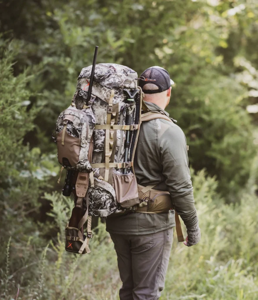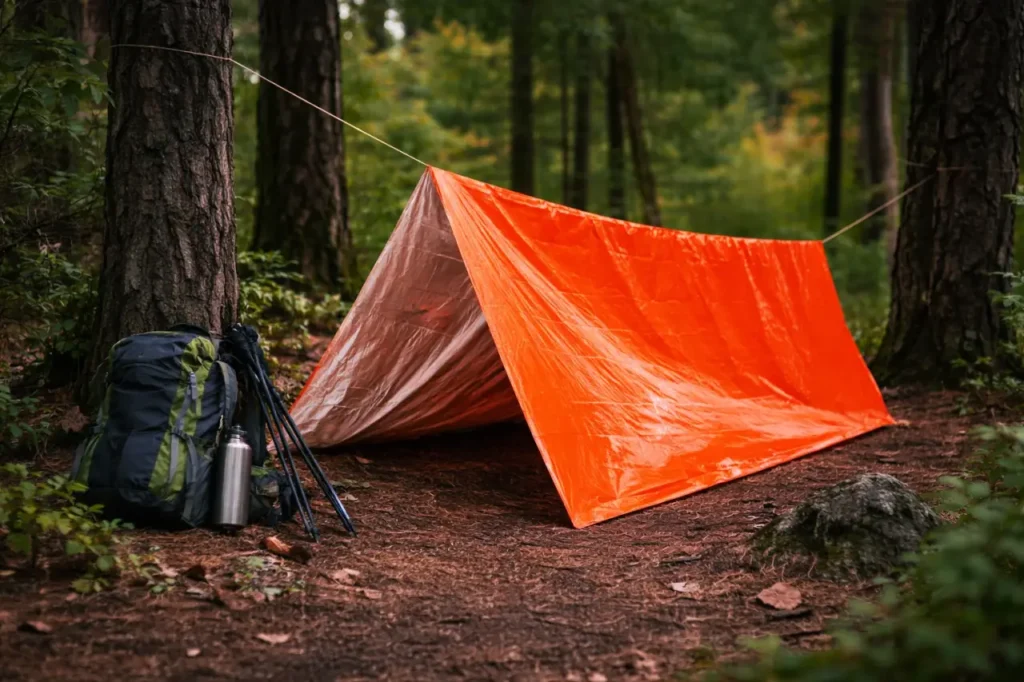
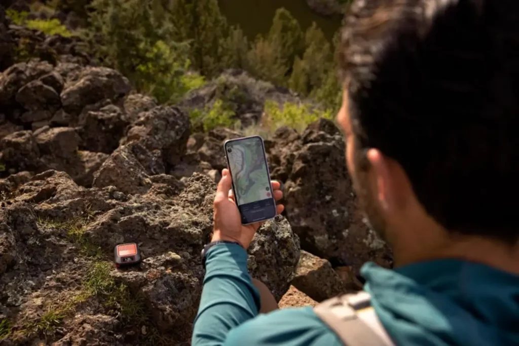
The trail looked obvious at the last junction. Twenty minutes later, the path has faded beneath pine needles, the slope feels steeper than expected, and every opening between the trees looks like it could be the way forward.
This is where a good navigation setup earns its place in your pack.
A smartphone can handle many hikes surprisingly well, especially when offline maps are downloaded ahead of time. But longer routes, unfamiliar terrain, poor weather, and remote areas call for something more dependable. That may be a rugged handheld GPS, a satellite communicator, a GPS watch, or simply a better-prepared phone setup.
The right choice depends less on owning the most advanced device and more on understanding what needs to happen when cell service disappears.
Do you need a detailed map on a dedicated screen? A way to contact family from camp? An SOS option for solo trips? A quick glance at the route while trail running? Or a simple, affordable way to avoid missing a turn on a popular day hike?
The best GPS devices for hiking solve different problems. Here is how the strongest options fit into real days on the trail. 🧭
Our Top Hiking GPS and Navigation Tools at a Glance
| Product | Best For | Key Feature | Price Tier |
|---|---|---|---|
| Garmin GPSMAP 67i | Remote backpacking and backcountry travel | Detailed maps plus inReach communication | $$$ |
| Garmin inReach Messenger Plus | Off-grid messaging and emergency communication | Satellite text, photo, and voice messages | $$ |
| Garmin eTrex Solar | Long trips and simple route following | Excellent battery life with solar assistance | $$ |
| Garmin fēnix 8 Solar Sapphire | Trail running and wrist-based navigation | Topographic maps and route guidance on the wrist | $$$$ |
| Gaia GPS App | Day hiking and budget-friendly navigation | Downloadable offline maps on a smartphone | $ |
Why Carry a Dedicated GPS for Hiking?
A smartphone is not a poor navigation tool. In many situations, it is one of the easiest ways to view a trail map.
The screen is large, route planning is simple, and apps such as Gaia GPS can store detailed maps for offline use. For a marked day hike near town, that may be all the navigation support you need.
The weakness is that the same phone is often handling everything else.
It may be your camera, flashlight, weather source, emergency contact, payment method, and ride back from the trailhead. Every photo, map check, video, and search for cell service takes a little more from the battery.
Cold temperatures can make that battery drain faster. Rain can make the screen difficult to use. A hard drop onto granite can end the day for more than just the mapping app.
A dedicated GPS or satellite communicator protects you from relying on a single fragile device for several important jobs.
A GPS Is Easier to Trust in Bad Conditions
Wet fingers and touchscreens rarely work well together. The same is true for thick gloves, snow, mud, and blowing dust.
A button-operated handheld such as the Garmin GPSMAP 67i may feel less sleek than a modern phone, but those controls remain usable when the weather turns. A rugged body also handles bumps, damp pack pockets, and rough use better than the average smartphone.
That does not make a GPS indestructible. It simply means the device was designed with outdoor conditions in mind.
Battery Life Becomes Less of a Daily Concern
On a long hiking day, constantly checking the remaining phone battery adds unnecessary stress.
A dedicated navigation device is built around location tracking, mapping, and route recording. It is not also downloading email, processing photos, or searching for a network.
Some handhelds can operate for several days between charges. Others use battery-saving modes, solar assistance, or replaceable batteries.
That extra runtime becomes especially valuable when a two-day route turns into three because of weather, fatigue, trail damage, or a slower-than-expected pace. 🔋
Navigation Remains Separate From Communication
Keeping navigation and communication on different devices creates useful redundancy.
A phone may provide the easiest map. A satellite communicator can handle check-in messages and SOS communication. A GPS watch can keep the route visible without repeatedly pulling the phone from a pocket.
When one device fails, the entire safety system does not disappear with it.
Satellite Communication Works Beyond Cell Coverage
Traditional GPS tells you where you are. It does not automatically give you a way to contact someone.
A satellite communicator connects through a satellite network rather than a cellular tower. With an active subscription, compatible devices can send messages, share a location, request weather information, and initiate an interactive SOS from remote areas.
This can be useful for serious emergencies, but it also helps with less dramatic situations.
A delayed hiker can send a message saying the group is safe but returning late. A backpacker can update family after changing campsites. Someone facing a washed-out trail can explain the new route instead of leaving others to wonder why the planned check-in never arrived.
The Best GPS Devices for Hiking Safety
Garmin GPSMAP 67i: Best Overall Handheld GPS
The Garmin GPSMAP 67i makes the most sense when both navigation and communication need to work without depending heavily on a phone.
It combines detailed mapping, physical controls, long battery life, multi-band positioning, and Garmin inReach satellite communication in a single rugged handheld.
That combination is especially useful on remote backpacking routes, off-trail adventures, hunting trips, and hikes through areas where the path may be faint or poorly marked.
The 3-inch color screen is smaller than a phone display, but it provides enough room to follow a route, check contour lines, locate waypoints, and understand the surrounding terrain. The physical buttons remain practical in rain, cold weather, and situations where gloves make touch controls unreliable.
The GPSMAP 67i also includes an electronic compass, barometric altimeter, and support for multiple satellite systems. These tools help with more than simply placing a dot on a map.
The compass can show direction while standing still. The altimeter helps track elevation gain and estimate how much climbing remains. The barometer can help identify changing pressure trends, although it should never replace a proper weather forecast.
Best For: Backpackers, hunters, backcountry hikers, wilderness travelers, and anyone who wants a dependable all-in-one navigation and communication device.
| Spec | Detail |
| Type | Handheld GPS and satellite communicator |
| Display | 3-inch color, non-touchscreen |
| Battery Life | Up to 165 hours in tracking mode; longer in expedition mode |
| Weight | Approximately 8.1 oz. |
| SOS | Yes, with active inReach subscription |
| Key Feature | Detailed mapping and two-way satellite communication |
What It Feels Like on the Trail
The main advantage is not having to assemble several pieces of gear every time the route becomes uncertain.
When a junction is missing a sign, the GPSMAP 67i can show the loaded route and surrounding topography. When camp is farther away than expected, the same device can send a message home. If the situation becomes serious, the SOS feature is already in hand.
It also means the phone can stay protected inside the pack, preserving its battery for photos, backup mapping, and communication near the trailhead.
The interface is not as immediately familiar as a smartphone. Menus, map screens, tracking settings, and messaging functions take time to learn.
Before taking it into remote terrain, load a route, mark a few waypoints, send a test message, and practice returning to the starting point. Familiarity matters more than the number of features printed on the box. 🌲
Pros:
- Combines detailed navigation and satellite communication
- Works without depending on a phone for core functions
- Physical buttons perform well in wet and cold conditions
- Multi-band positioning helps in challenging terrain
- Long battery life suits multi-day trips
- Includes compass, altimeter, and barometer
- Supports two-way messaging and interactive SOS
Cons:
- Heavier than a compact satellite messenger
- More expensive than a phone-based setup
- Menus require practice
- Satellite features require a subscription
- Small screen is less comfortable than a phone for studying large map areas
The Garmin GPSMAP 67i at REI is the strongest fit for hikers who want one rugged device to handle the most important navigation and communication tasks.
Garmin inReach Messenger Plus: Best for Off-Grid Communication
Some hikers are perfectly comfortable using a smartphone for maps. The missing piece is a reliable way to communicate when the phone loses service.
The Garmin inReach Messenger Plus fills that gap without adding the size and complexity of a full handheld GPS.
It pairs with a compatible phone through the Garmin Messenger app, making it easy to type messages on a familiar screen. When cellular service or Wi-Fi is unavailable, messages can be sent through the satellite network with an active plan.
The Messenger Plus supports text, photo, and voice messages. The extra formats are more useful than they may initially sound.
A photo can show the condition of a damaged trail, vehicle, or piece of equipment. A short voice message can explain a complicated delay more clearly than a few lines of text typed with cold fingers.
The device also supports location sharing, weather information, check-in messages, and interactive SOS communication.
Best For: Day hikers, backpackers, paddlers, road-trippers, and families who already use a phone for maps but want dependable communication beyond cell coverage.
| Spec | Detail |
| Type | Satellite communicator |
| Display | Small monochrome device display |
| Battery Life | Varies by tracking interval, messaging use, and sky conditions |
| Weight | Approximately 4 oz. |
| SOS | Yes, with active inReach subscription |
| Key Feature | Satellite text, photo, and voice messaging |
What It Feels Like on the Trail
The Messenger Plus is easy to forget about until it is needed—which is exactly why it should be stored somewhere accessible.
Attach it securely to a shoulder strap, hip belt, or another location that can be reached without removing the pack. Keeping an emergency communicator buried beneath cookware and extra layers defeats much of its purpose.
For normal use, the phone provides the more comfortable interface. Messages are easier to write, contacts are easier to find, and conversations are easier to follow.
The device still retains essential standalone functions if the phone loses power or becomes damaged. That provides a useful backup, but the small display is not designed for comfortable, extended messaging.
This is not the right option for someone who wants a large map screen and detailed standalone navigation. Its job is communication, and it does that without taking up much room.
Pros:
- Provides communication beyond cellular coverage
- Supports text, photo, and voice messages
- Compact enough for lightweight hiking kits
- Pairs with a phone for easier messaging
- Includes location sharing and interactive SOS
- Useful for both routine check-ins and emergencies
- Can remain functional if the phone becomes unavailable
Cons:
- Not a full mapping GPS
- Most functions are easier through a paired phone
- Requires an active service plan
- Small screen limits comfortable standalone use
- Costs more than the basic inReach Messenger
The Garmin inReach Messenger Plus works best beside an offline mapping app, GPS watch, or separate handheld navigation device.
Garmin eTrex Solar: Best for Long Battery Life
Not every hike requires satellite messaging, color maps, and a long list of training metrics.
Sometimes the most useful device is the one that quietly records a track, marks important locations, points toward the next waypoint, and keeps running without constant charging.
The Garmin eTrex Solar is built around that simpler approach.
Its 2.2-inch monochrome display is basic compared with a smartphone or color handheld, but it remains easy to see in bright daylight. Multi-band GPS improves positioning, while solar-assisted charging helps extend an already impressive battery life.
Garmin rates the device for up to 200 hours of use without solar charging under certain settings. In strong sunlight, solar exposure can stretch that runtime further.
The eTrex Solar can pair with the Garmin Explore app for route planning, trip organization, weather information, and software updates.
Best For: Long-distance hikers, geocachers, hunters, minimalist backpackers, and anyone who wants straightforward navigation with minimal battery management.
| Spec | Detail |
| Type | Compact handheld GPS |
| Display | 2.2-inch monochrome |
| Battery Life | Up to 200 hours without solar charging |
| Weight | Approximately 5 oz. |
| SOS | No |
| Key Feature | Multi-band GPS with solar-assisted battery life |
What It Feels Like on the Trail
This is a device for checking direction rather than exploring a richly detailed map.
A prepared route can be loaded before the hike. Along the way, the eTrex Solar can show whether progress is still aligned with that route, how far away the next waypoint is, and where the track has already traveled.
That is often enough on long, established routes where the main concern is confirming direction and recording progress.
The small monochrome screen becomes more limiting when the terrain is complicated. Studying alternate trails, nearby drainages, and large topographic areas is easier on a phone or larger handheld.
It also does not include satellite messaging or SOS. Hikers entering remote areas may still want to pair it with a separate communicator.
The reward for accepting those limitations is less time thinking about charging. On a trip where outlets are days apart, that simplicity can be a major advantage. ☀️
Pros:
- Excellent battery life
- Solar assistance can extend runtime
- Multi-band positioning
- Compact and relatively lightweight
- Screen remains readable in bright sunlight
- Useful for recording tracks and following prepared courses
- Less complicated than a full-featured mapping handheld
Cons:
- Small monochrome display
- Limited for detailed map study
- No satellite communication or SOS
- Requires more route preparation before the trip
- Less versatile than the GPSMAP 67i
The Garmin eTrex Solar on Amazon is a practical choice for hikers who prefer long runtime and straightforward navigation over a large screen and advanced communication features.
Garmin fēnix 8 Solar Sapphire: Best All-in-One GPS Watch
Pulling a phone or handheld GPS from a pocket at every intersection gets old quickly, especially while running, moving with trekking poles, or hiking in cold weather.
The Garmin fēnix 8 Solar Sapphire keeps navigation on the wrist.
It provides topographic maps, route guidance, multi-band positioning, elevation data, activity tracking, and a wide range of outdoor and fitness features in a rugged watch.
The touchscreen makes everyday use easier, while physical buttons remain available when rain, sweat, gloves, or snow make touch controls unreliable.
Solar charging can extend battery life, depending on the watch size, sunlight exposure, GPS mode, and how often maps and other features are used.
Best For: Trail runners, fastpackers, mountain athletes, and hikers who want route guidance without repeatedly stopping to check another device.
| Spec | Detail |
| Type | Multisport GPS watch |
| Display | Color touchscreen with physical buttons |
| Battery Life | Varies by model size, GPS mode, and solar exposure |
| Weight | Varies by model size |
| SOS | No independent satellite SOS |
| Key Feature | Topographic maps and route guidance on the wrist |
What It Feels Like on the Trail
The biggest benefit is how quickly route information becomes available.
A glance can show whether the trail turns at the next junction, how far remains to the summit, and how much climbing is still ahead. If a wrong turn happens, the watch can reveal that the recorded track is moving away from the planned course before the mistake becomes a long detour.
This is particularly useful for trail runners and fastpackers who do not want to stop every few minutes.
The tradeoff is screen size. A watch is excellent for following a loaded route but less comfortable for studying the surrounding landscape. When a trail closes or a route needs to be changed, a phone or larger GPS provides a better view of the alternatives.
The watch also contains far more features than most hikers will use. Training readiness, health tracking, activity profiles, navigation screens, battery modes, and map settings take time to configure.
It is also important to understand what the fēnix 8 does not do. It is not a standalone satellite communicator. In remote areas without cellular service, it cannot replace an inReach device.
Pros:
- Keeps route guidance visible on the wrist
- Useful for frequent checks while moving
- Includes topographic maps and multi-band positioning
- Physical buttons work in poor weather
- Tracks elevation, pace, distance, and outdoor activities
- Solar charging can extend battery life
- Works for hiking, running, skiing, climbing, and everyday use
Cons:
- Very expensive
- Small screen is not ideal for studying complex terrain
- No independent satellite messaging or SOS
- Large number of features can feel overwhelming
- Battery performance depends heavily on settings
- More watch than many casual hikers need
The Garmin fēnix 8 Solar Sapphire at REI makes the most sense for hikers who will use its navigation, fitness, and everyday smartwatch features regularly.
Smartphone with Gaia GPS: Best for Budget-Conscious Hikers
For a marked trail, a weekend campground, or a familiar day-hiking area, a dedicated GPS may be unnecessary.
A smartphone with Gaia GPS can provide detailed maps, route planning, waypoint creation, track recording, and offline navigation without adding another device to the pack.
The important detail is preparation.
A phone can receive GPS location information without cell service, but the map itself may not be available unless it was downloaded before the hike. Open the route at home, save the required map area for offline use, and confirm that it loads while the phone is in airplane mode.
Gaia GPS offers a variety of map layers that can help with different types of trips. Topographic maps show elevation and terrain. Satellite imagery can reveal roads, clearings, and landscape features. Public-land layers can help hikers understand boundaries and access.
Best For: Day hikers, beginners, car campers, and backpackers on established routes who want useful navigation without buying a separate GPS.
| Spec | Detail |
| Type | Smartphone mapping app |
| Display | Smartphone screen |
| Battery Life | Depends on the phone, temperature, screen use, and settings |
| Weight | No additional device beyond the phone |
| SOS | Not through Gaia GPS alone |
| Key Feature | Detailed downloadable maps and easy route planning |
What It Feels Like on the Trail
The large screen is Gaia GPS’s biggest advantage.
It is easier to study contour lines, nearby trails, roads, water sources, and possible turnaround points on a phone than on most small handheld displays. Route planning is also more comfortable, particularly when using the desktop version before the trip.
Battery management is the part that requires discipline.
Keep the phone in airplane mode where appropriate, reduce screen brightness, close unnecessary apps, and avoid checking the map every few minutes. Carry a fully charged power bank on longer days.
Cold weather deserves extra attention. Store the phone close to the body rather than in an exposed pack pocket, since low temperatures can reduce battery performance.
A waterproof case or protective pouch is also useful, even when the phone itself has a water-resistance rating.
Pros:
- Uses a device most hikers already carry
- Large screen makes maps easier to read
- Supports routes, tracks, waypoints, and offline maps
- Useful for planning trips before leaving home
- Lower upfront cost than a dedicated GPS
- Offers multiple detailed map layers
Cons:
- Battery life varies widely
- Phone may also be needed for photos and communication
- Touchscreen can be difficult in rain or with gloves
- More vulnerable to drops and cold temperatures
- Offline maps must be downloaded ahead of time
- Does not provide satellite SOS on its own
Gaia GPS works best as part of a prepared system: downloaded maps, a protective case, backup power, and a second way to navigate if the phone stops working.
How to Choose the Best Hiking GPS for You
The easiest way to choose is to think about the moments when navigation usually becomes difficult.
A marked trail in a busy state park creates different problems from a remote route across open desert. A trail runner needs quick route checks. A backpacker may care more about battery life and communication from camp.
Start with the kind of trips that happen most often.
Choose a Handheld GPS When Navigation Comes First
A handheld GPS is the strongest option when the route is remote, complicated, or unfamiliar.
The larger display and detailed maps make it easier to understand terrain than a watch. Physical buttons work well in poor weather, and battery life is usually more predictable than a phone.
Choose the Garmin GPSMAP 67i when satellite communication is also important.
A handheld is probably more than necessary for short walks on well-marked urban trails, but it becomes easier to justify when the trail fades, junctions are unmarked, or the trip lasts several days.
Choose a Satellite Messenger When Communication Comes First
A satellite messenger is the better fit when phone-based navigation already works well but cell service disappears along the route.
It allows family or friends to receive updates without waiting for the hiker to return to coverage. It also creates a way to request help during an emergency.
The Garmin inReach Messenger Plus is particularly useful for hikers who want richer communication options without carrying a full handheld GPS.
Choose a GPS Watch When Frequent Map Checks Interrupt the Pace
A watch works well when stopping to check a phone becomes frustrating.
Trail runners, fastpackers, and hikers using trekking poles can follow a route with quick glances at the wrist. The display is small, but it is always accessible.
A watch is best for following a route that was planned in advance. It is less useful for making complicated route changes in the field.
Choose a Smartphone App for Established Trails and Tighter Budgets
A phone with Gaia GPS is enough for many day hikers.
It provides detailed maps on a familiar screen, costs less than buying another device, and adds almost no extra weight.
The setup becomes less reliable when the phone is the only source of maps, communication, photography, and emergency access. Carry backup power and avoid using it as the only navigation method on remote trips.
SOS and Satellite Communication
An SOS button should be treated as a last-resort safety tool, not as permission to enter the backcountry unprepared.
Satellite communication can shorten the time between an emergency and a request for help, but rescue is never immediate or guaranteed. Weather, terrain, distance, available personnel, and the type of incident all affect the response.
Before leaving:
- Confirm that the service plan is active
- Charge the device fully
- Update the device and companion app
- Send a test message
- Review the SOS procedure
- Check that emergency contacts are current
- Make sure someone has the planned route and return time
Keep the device attached to the body or within easy reach. A communicator may become inaccessible if a pack is lost during a river crossing, fall, or injury. 🆘
Mapping and Navigation Features That Matter
Long feature lists can make GPS devices difficult to compare. Focus on the functions that help answer real questions on the trail.
Offline Maps
Maps should remain available when cell service disappears.
Download the full route area rather than only a narrow strip around the trail. A wider map gives more context if a detour, closure, or wrong turn occurs.
Route Following
A planned route helps confirm whether the hike is still moving in the intended direction.
Look for clear turn prompts, distance to the next point, and an obvious indication when the track moves away from the course.
Waypoints
Waypoints can mark the trailhead, campsite, water source, vehicle, junction, or emergency exit.
Marking the vehicle before starting is a simple habit that can prevent confusion at the end of a long day.
Track Recording
A recorded track shows where the hike has already traveled.
This can help with retracing steps, reviewing distance, and identifying the point where the route changed.
Multi-Band Positioning
Multi-band GPS can improve positioning in challenging environments such as narrow canyons, steep valleys, and dense forests.
It may also use more battery. Select the most demanding mode when terrain requires it rather than leaving every device on its highest-power setting by default.
Battery Life in the Real World
Battery estimates are useful for comparing devices, but they are not guarantees.
Cold weather, constant screen use, frequent messaging, bright displays, difficult satellite reception, and continuous tracking can all reduce runtime.
For a day hike, start with a full charge and enough reserve for an unexpected delay.
For multi-day trips, decide how the device will be powered before reaching the trailhead.
Useful options include:
- Spare AA batteries for compatible devices
- A rechargeable power bank
- Shorter periods of screen use
- Reduced tracking frequency
- Expedition or battery-saver modes
- Solar charging in consistently sunny conditions
Do not depend entirely on a small solar panel without testing it first. Trees, clouds, pack angle, and short winter days can reduce charging far below ideal laboratory conditions.
Durability and Ease of Use
A GPS device should be easy to operate when conditions are not.
Physical buttons usually perform better in rain, snow, and cold weather. Touchscreens make map movement and menu navigation more intuitive in dry conditions.
Look for a strong water-resistance rating, secure attachment options, and controls that can be used while wearing the gloves normally taken hiking.
Also pay attention to startup time and menu complexity. A powerful device is not useful when its essential functions are buried in unfamiliar screens.
Spend an afternoon practicing close to home before taking a new GPS into the backcountry.
Don’t Forget the Classics: Map and Compass
Electronics solve many navigation problems, but they can still fail.
Batteries run down. Charging cables break. Screens crack. Routes are downloaded incorrectly. A device can also show an accurate location on an inaccurate or outdated trail map.
A printed topographic map and compass remain valuable because they require no signal, battery, subscription, or software update.
They are only effective when the basics are familiar.
Practice orienting the map, identifying terrain features, understanding contour lines, taking a bearing, and matching the map to the surrounding landscape.
A paper map also provides a broader view than a watch or small handheld. It can make alternate routes, roads, drainages, ridgelines, and emergency exits easier to understand.
For remote trips, leave a trip plan with someone responsible. Include:
- Trailhead and vehicle information
- Planned route
- Expected campsites
- Intended return time
- Names of everyone in the group
- The time at which help should be requested
Final Verdict: Which GPS Device Should You Take Hiking?
Choose the Garmin GPSMAP 67i when remote navigation and satellite communication both matter. It is the most complete option for backpacking, backcountry hiking, and trips where the phone should remain a backup rather than the primary tool.
Choose the Garmin inReach Messenger Plus when a phone, watch, or separate GPS already handles maps. It provides off-grid communication in a compact device without the bulk of a full handheld.
Choose the Garmin eTrex Solar when battery life and simple route following matter more than detailed color maps or messaging.
Choose the Garmin fēnix 8 Solar Sapphire when route information needs to stay visible while running or hiking. It is expensive, but its combination of navigation, activity tracking, and everyday watch features may justify the cost for someone who will use it often.
Choose Gaia GPS when hiking established trails and keeping costs down. Prepare the phone carefully, download maps in advance, and carry backup power.
The strongest setup is usually not a single device.
A phone with offline maps plus a satellite communicator provides detailed navigation and off-grid communication. A GPS watch plus a paper map creates convenient route following with a simple backup. A handheld GPS plus a phone offers two independent ways to see the trail.
The goal is not to carry more electronics than necessary. It is to avoid reaching a confusing junction, injured ankle, or unexpected delay with only one way to solve the problem.
Frequently Asked Questions About Hiking GPS
Do I really need a GPS if I have my phone?
A phone may be enough for short hikes on established trails, provided maps are downloaded for offline use and the battery is managed carefully.
A dedicated GPS becomes more useful on remote routes, multi-day trips, off-trail travel, and hikes where weather or terrain could make a phone difficult to use.
A satellite communicator should be considered separately when cellular coverage is unreliable.
Does GPS work without cell service?
Yes. GPS positioning does not require cellular service.
A phone can usually determine its location without a signal, but it may display a blank screen if the necessary maps were not downloaded before the hike.
Test offline navigation at home by placing the phone in airplane mode and opening the saved route.
What is the difference between a GPS and a satellite messenger?
A GPS device primarily helps with navigation. It shows location, follows routes, records tracks, and stores waypoints.
A satellite messenger primarily helps with communication. It can send messages, share a location, and initiate an SOS outside cellular coverage.
Some devices, including the Garmin GPSMAP 67i, combine both functions.
Are satellite messenger subscriptions worth it?
They are often worthwhile for solo hikers, remote backpackers, wilderness travelers, and anyone regularly exploring areas without dependable cell service.
The subscription provides access to the satellite network and emergency communication services. Review current plan details carefully because activation fees, message limits, tracking costs, and monthly options can change.
Can a satellite messenger guarantee a rescue?
No.
A satellite messenger can send an emergency request and allow communication with a response center. It cannot guarantee how quickly help will arrive.
Terrain, weather, distance, agency availability, and the type of emergency all affect rescue timing.
Proper clothing, shelter, water, navigation skills, first-aid supplies, and realistic trip planning remain essential.
How accurate are hiking GPS devices?
Accuracy depends on the device, terrain, sky visibility, satellite configuration, and atmospheric conditions.
Modern multi-band devices can be very accurate in open areas. Dense forests, cliffs, and narrow canyons may still interfere with positioning.
Compare the GPS with the terrain, map, trail signs, and planned route rather than following the screen without question.
Can a GPS watch handle a multi-day hike?
Yes, but battery settings matter.
Continuous GPS tracking, map use, screen brightness, temperature, and sensor activity all affect runtime. A power bank may be necessary on longer trips.
Select a GPS mode that provides enough accuracy without using more power than the route requires.
Should a phone stay in airplane mode while hiking?
Airplane mode can reduce battery drain by preventing the phone from repeatedly searching for cellular service.
GPS location usually continues to work, though settings vary by phone. Test the setup before the trip and confirm that maps and routes remain available offline.
Is a map and compass still necessary?
For remote hiking, carrying them is a sensible backup.
They are lightweight, require no power, and provide a broader view of the terrain. They are most useful when map and compass skills have been practiced before the trip.
Affiliate Disclosure: GearForTheOutdoors.com participates in affiliate programs, including REI, Amazon, REI Outlet, Garage Grown Gear, evo, and other trusted partners. When you purchase through our links, a small commission may be earned at no extra cost to you. That helps support the content and keeps the recommendations useful, practical, and free.
Disclaimer: This post is for informational purposes only. Always verify current product details, compatibility, availability, subscription requirements, safety information, and manufacturer warranties before purchase or use. Outdoor conditions and gear performance can vary depending on setup, weather, terrain, location, and experience level.